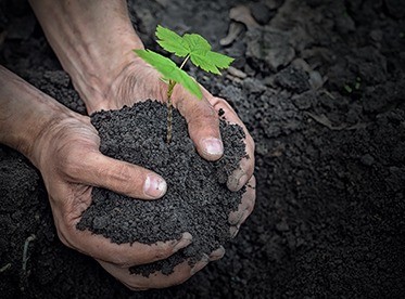
The nation that destroys its soil, destroys itself
-Franklin D Roosevelt
Soil is one of the most important natural resources of earth. It lays strong foundation for sustainable ecosystem. There is unanimity among experts of climate change and soil science that soil has instrumental role in mitigating the impact of climate change. It can store more carbon than total sum of forest resources. Majorly, soil functions are as following:
- Food and other biomass production
- Environmental Interaction: storage, filtering, and transformation
- Biological habitat and gene pool
- Source of raw materials
- Physical and cultural heritage
- Platform for man-made structures: buildings, highways ( ISRIC, 2022)
However, recent surge in anthropogenic activities and other allied factors are responsible for soil degradation. Soil degradation corresponds to a state of declining soil fertility, changes in alkalinity, and acidity, deteriorating structural condition of soil, and extreme flooding. Consequences of soil degradation can be lethal such as land degradation, drought & aridity, loss of arable land, flooding etc.
Availability of Soil Maps: Significance & Need
It is therefore essential to have accurate soil maps for assessing the current status of soil in terms of understanding about its health and for identifying the factors responsible for its degradation. Moreover, availability of accurate soil maps is indispensable for solving global challenges such as food security and climate change. It is essential to understand that inaccurate soil map may attribute to escalating inaccuracies in studies relating to climate change, agriculture, food security and investigations on other components of earth system. Hence, accurate soil mapping is an absolute requirement when we aim to work towards making earth a sustainable habitat.
Soil Mapping: Impact of Climate Change & Issues
As aforementioned, soil is one of the most important components of earth system. It is hugely responsible for regulating functions and services of ecosystem. And so availability of accurate soil datasets is a must criterion for accurate and precise investigations on sustainability. However, available global soil datasets may not serve the purpose entirely due to following reasons:
- Preparation of soil map using limited soil profile datasets.
- Course resolution datasets
- Uncertain sources
Soil Mapping: Initiatives & Efforts from Institutions across Globe
Increasing need of seamless and accurate soil maps compelled researchers and policymakers of soil science across world to adopt digital soil mapping instead of traditional mapping. And it has become the most significant shift in recent decades in the context of efforts for modernizing soil mapping.
However the shift has not been smooth as digital soil mapping is enveloped with challenges and limitations in the context of data availability at continuous intervals and in high resolution. It therefore pushed the organisations across world to devise and develop frameworks for confronting the aforementioned challenges. For instance, digital soil mapping now can update soil products continuously subject to the availability of new field observations and high resolution imageries. In similar manner, high performance computing is also now actively in picture for digital soil mapping. There is no doubt that the journey of soil mapping has come far due to the efforts of researchers and organisations across world. However challenges still looms and therefore, a long way to go.
Proposed solution from LeadsConnect
While preparing accurate and precise soil map, it is very important to collect a large number of soil profiles for representing the actual scenario effectively. In addition, it is very important to have a framework which can decipher the relationship between soil characteristics and the other biophysical parameters. This understanding may help in generating the soil map more accurately. LeadsConnect can play a significant role in preparing accurate soil maps for India due to following reasons:
- The company has Pan-India presence and therefore, collection of adequate number of soil profiles will not be a hindrance.
- Availability of in-house developed DeepTech platform for performing accurate association analysis between the collected soil profiles and corresponding biophysical parameters which helps in developing accurate soil maps.
- Availability of in-house developed DeepTech platform for performing sensitivity analysis to identify any possible aberration in the developed soil maps.
- Comprehensive validation is possible due to pan India presence of company.
- One stop platform for generating high resolution soil map using the collected soil profiles, finding of association analysis, SpaceTech analytics and error correction coefficients from field verifications.
- The company is also fully equipped for providing ‘Drone Analytics as a Service’ (DrAAS). Drone Analytics can also be used for preparing high-resolution and accurate soil maps. Specifically, DrAAS has paramount importance in collecting precise soil profiles and for performing robust association analytics. Observations from Drone Analytics can also be used as add-on inputs to the in-house one stop DeepTech platform for generating high resolution soil map.