Agriculture is an integral part of a nation’s economy, be it producing food resources or trading. Producing efficient crops takes a lot of planning, management, analysis and precautions, as farming majorly depends on the environment and climatic conditions. Many factors can affect soil health and crop quality, like rain, floods, and infestations. Remote sensing and Geographic Information Systems are technologies that can help prevent any crop damage and keep the soil healthy by analysing the yield and managing cultivation throughout the production process.
These technologies effectively work on crop identification, condition assessment, area estimation, moisture estimation, water management and meteorological data analysis. These are explained in detail below:
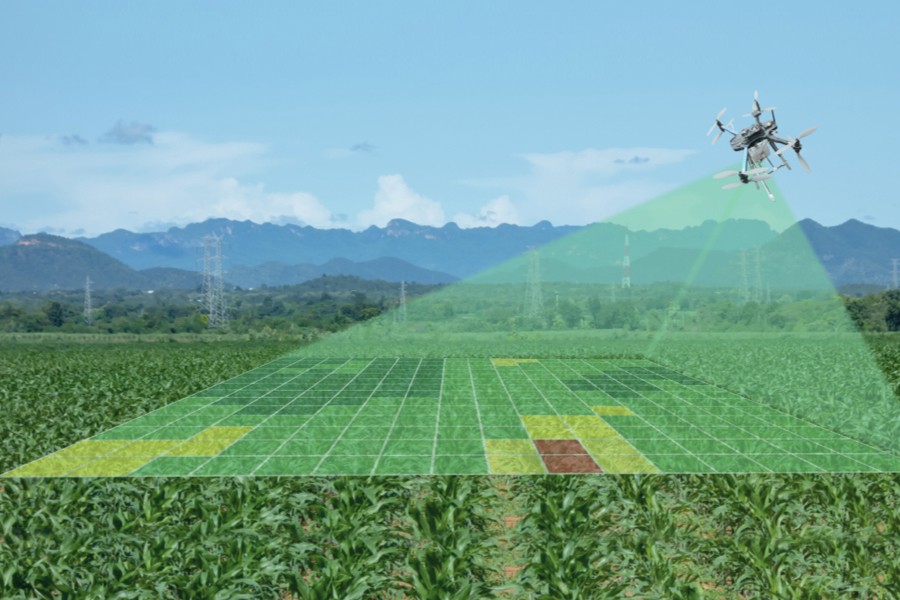
Crop Yield Analysis
The data collected using remote sensors, and GIS can help improve farmers’ decision-making capabilities. These technologies allow for gathering data about the previous season’s crops, terrain specifics, pH levels, moisture levels and organic matter content as an in-depth analysis can help prepare a proper farming schedule.
Moreover, agricultural geospatial technology is important in monitoring crop growth and its management to sustain natural resources and agricultural productivity. Fertile soil is one of the most important requirements for growing good crops. In farm management practices, it is essential to consider soil properties so that the farmers don’t use an infertile soil base for growing fresh crops, as it will only lead to failure. When farming is not planned correctly, it leads to nutrient deficiency in the soil. Hence, technologies like remote-based sensing and geospatial analysis are essential as they help analyse soil properties.
Flood Monitoring
Many regions in India are prone to flash floods which lead to damage to a majority of agricultural areas in the country. In such a situation, if the farmers use services like remote sensing and GIS, they can access all the data provided by these technologies and use that data to plan out an efficient strategy to prevent and deal with the damage.
Crop Stress and Disease Detection
In many farming situations, climate change often affects farm planning by changing the farming and harvesting cycle, which leads to bad crop conditions and causes diseases. If the crops catch any infection or pest, it compromises a lot of produce. However, if the farmers start using these technologies to identify pests and provide a suitable mechanism to control them, it will save all the crops from being compromised.
Land Mapping
The landscape usually consists of forests, water bodies, paved surfaces etc. It can change with time, so land mapping is done so that the farmers can understand the current state of land use and cover. Various technologies like GIS can help one in land mapping procedures. Leads Connect provides accurate means to derive this information and detailed analysis to help farmers plan land usage accordingly.
Pest Infestation
Crops are prone to damage by calamities and are exposed to pests and diseases. With the help of technologies like remote sensing, satellite imagery and geospatial analysis, it can be easy to identify areas that are affected by infestations like Mealybugs, White Flies and Plant Hoppers. It analyses disease symptoms like chlorosis, yellowing leaves, foliage reduction etc.
So, efficient use of these technologies can help farmers identify infected areas and find a solution to eliminate them before they spread.
Water Resource Management
One of the significant issues faced by farmers is water scarcity. It is a global issue, so applying the best technology to tackle this major issue is essential. Hyperspectral technology is capable of getting information about spatial, spectral and temporal variations in water resources. In other words, it helps in assessing the soil’s moisture level and groundwater availability. This assessment can help farmers in planning a sustainable use of these resources.
All these points list the uses and advantages of technologies like remote sensing and GIS in the field of agriculture. Leads Connect offers these technologies and farm management services to help farmers manage their farms better and more efficiently.